Livingston Area Trails
Check out our new interactive Parks & Trails Map!
Bitterroot Trail: ½ mile
The Bitterroot Trail is a half-mile gravel walking path funded by in-kind work from the City of Livingston and grant funding from the Montana Fish, Wildlife & Parks Recreational Trails Program. The trees and landscaping were generously donated by Northwestern Energy. Constructed to accompany the Summit Trail located only a quarter mile away, the Bitterroot Trail is part of a network designed to connect the Northside Soccer Fields to adjoining residential neighborhoods, providing a convenient and safe route to and from one of Livingston’s most frequently used recreational complexes.
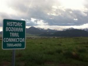
Bozeman Trail Connector: 1 mile
The Bozeman Trail is a one mile gravel walking path funded by in-kind work from the City of Livingston and grant funding from the Montana Fish, Wildlife & Parks Recreational Trails Program.
The Bozeman Trail serves as a convenient and scenic connecting route from Livingston’s Northern Lights Subdivision to Fleshman Creek Road. The trail borders Fleshman Creek and features two small lakes that serve as home for a variety of birds and wildlife. Located only a half mile via City streets from the Northside Soccer Fields and the Bitterroot Trail, the Bozeman Trail can easily be incorporated into a longer walk or run.
Highway 89 South Walking and Bike Path: 4 ½ miles
The Hwy 89 South Bike Path is a four-and-a-half mile asphalt trail funded by the City of Livingston and Park County. It begins near downtown Livingston on North 5th Street and runs South along Park Street until it stops at the intersection of Hwy 89 South and East River Road at Carter’s Bridge. This path is a great option for a longer run or bike ride with plenty of beautiful and varied scenery.
Moja Dog Park Trail: ¼ mile
Take your dog for a walk on this scenic quarter-mile gravel trial that lies on the bank of the Yellowstone River. The Moja Dog Park Trail is right next to Mayor’s Landing and a very popular destination for visitors and local residents alike.
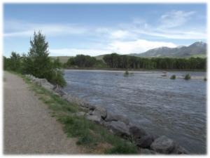
Myers’ River View Trail: 1 mile
The Myers’ River View Trail is a one mile gravel walking path that borders the Yellowstone River. It was funded by in-kind work from the City of Livingston and grant funding from the Montana Fish, Wildlife & Parks Recreational Trails Program. A donation from the Kodak Foundation purchased the trail’s descriptive signs which feature native wildlife photographs and information. The Artemis Institute constructed the trail head and special trail features that blend in with the natural surroundings. Some of these features include wind pipe whistles, natural benches and a lookout over the river. With stunning views of the Yellowstone, Myers’ River View Trail is a perfect destination for a scenic stroll, a family picnic, or an afternoon run.
Summit Trail: 1/2 Mile
The Summit Trail is a half-mile gravel walking path funded by the City of Livingston. It was constructed to accompany the Bitterroot Trail, located only a quarter mile away. The Summit Trail has a significant uphill grade and two access points: one on Montana Street and one on West Summit Street. This trail is part of a network designed to connect the Northside Soccer Fields to adjoining residential neighborhoods, providing a convenient and safe route to and from one of Livingston's most frequently used recreational complexes.
Yellowstone River Levy Trail: ¾ mile
The Yellowstone River Levy is a three-quarter mile dirt walking path constructed by the City of Livingston under the direction of the Army of Corps of Engineers. This levy borders the Yellowstone River, offering breathtaking views of the last free-flowing river in the lower 48 states as well as direct access to Sacajawea Park, the Band Shell and the Miles Park Baseball Complex.